The Berlin Wall Trail: 160 km of Mauerweg in Sections You Can Actually Walk or Cycle in a Day
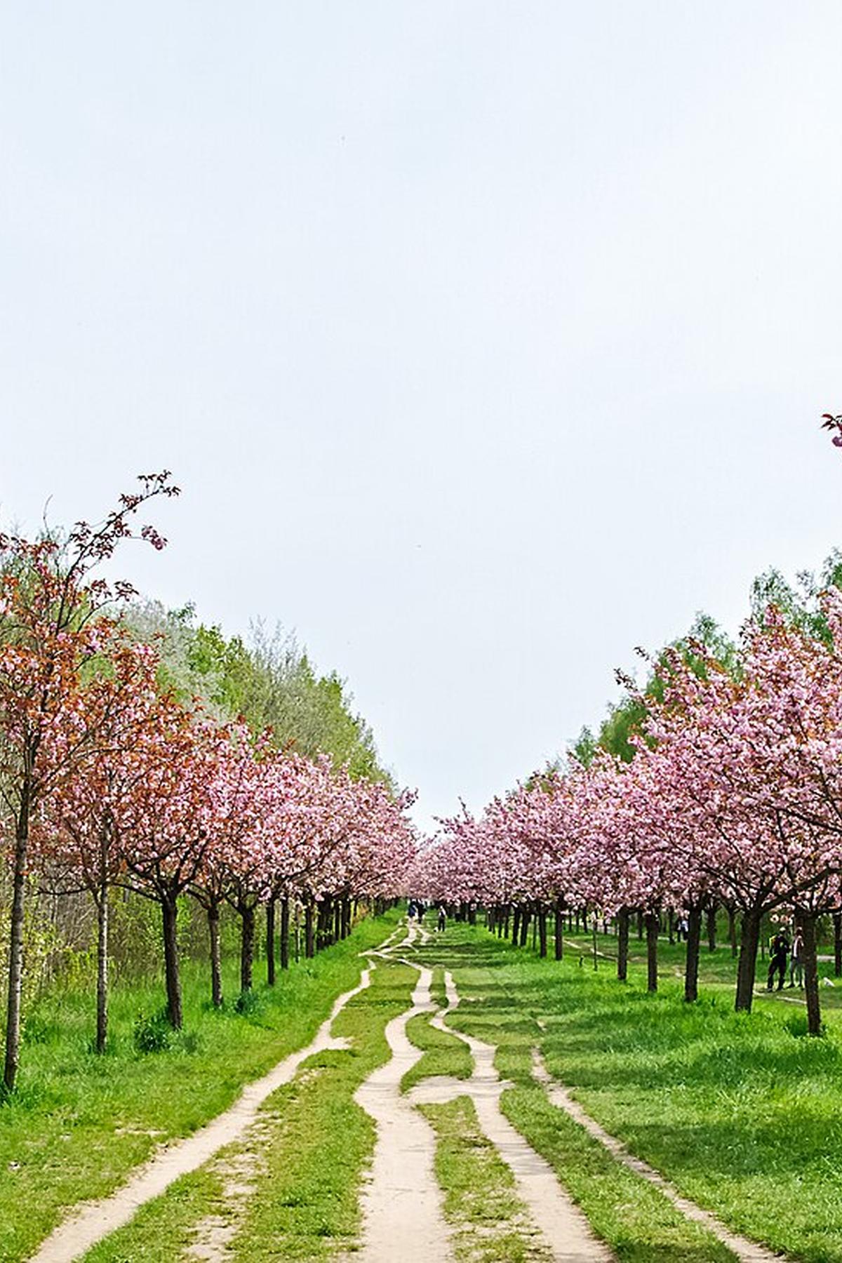

The Berlin Wall Trail: 160 Km of Mauerweg in Sections You Can Actually Walk or Cycle in a Day
The Berlin Wall Trail is not a straight line through the centre of Berlin. The 160 km Mauerweg traces the full circuit that enclosed West Berlin, looping through outer suburbs like Staaken and Schönefeld as well as the central death strip. Most visitors arrive expecting a single continuous wall to walk along. That was demolished in 1990-91. The experience today is a fragmented scavenger hunt between memorial stretches, a double row of cobbles set into the tarmac across Mitte and Kreuzberg, and repurposed border crossings. You can find Berlin Wall Trail sections you can actually do in a day. Pick the right start and end points with an S-Bahn connection at both ends.
Mauerweg Cycling Route: Why the Full 160 Km is Not the Right Call
Senatsverwaltung für Mobilität, Verkehr, Klimaschutz und Umwelt (Berlin) maintains 14 signed stages of the Mauerweg. Each stage runs 10 to 14 km. The full circuit has been continuous since 2006. A fit cyclist could ride the entire 160 km in about 10 hours, but you would miss every landmark. The Mauerweg cycling route works best when you treat each stage as a standalone trip, not a marathon. The BVG U-Bahn and S-Bahn network lets you start at one station, walk or cycle a stage, and ride back from the endpoint. You need a paper or app-based ticket validated before boarding. The single most common trap is forgetting to stamp a ticket in the small red box on the platform. An on-the-spot fine from BVG controllers costs up to €60 and ends the day early.
Berlin Wall Path Best Segments for a Single Day
Three concrete stretches of the Berlin Wall path work for a walker or cyclist with a single day.
Central Urban Corridor
The central 7 km urban corridor runs from Bernauer Strasse to the East Side Gallery. It is the most intact and the most touristed.
Southern Wooded Riverside Route
The southern 15 km wooded riverside route leads from Treptow to Schönefeld. Asphalt dominates. It is quiet on weekdays.
Western Lakeside Stretch
The western 20 km along the Havel and Wannsee is the quietest segment of the entire circuit. Each has its own S-Bahn start and end point, its own surface, and its own set of landmarks. Book the day from 09:00 to 17:00. That gives you time for a stop, a detour, and a train back without rushing.
Central 7 Km: Bernauer Strasse to Mauerpark to East Side Gallery
Start at Bernauer Strasse S-Bahn station (Nordbahnhof on Stage 1). The Bernauer Strasse Wall Memorial preserves an original death strip with reconstructed border elements. The path here runs on the original patrol road surface. Walk south along the double row of cobbles set into the ground that traces the green corridor, once the inner-city death strip. In 20 minutes you reach Mauerpark, a Sunday morning karaoke flea market on the old border strip between Wedding and Prenzlauer Berg.
From Mauerpark To The Spree
Continue south past the Nordbahnhof S-Bahn station, then follow the path along the Spree river to the East Side Gallery. That 1.3 km canvas of Wall paintings runs from the Oberbaumbrücke U-Bahn bridge to the Ostbahnhof. Total distance: about 7 km. Time: 2 to3 hours walking,45 minutes cycling. End at the East Side Gallery. Take the U-Bahn from Warschauer Strasse back to your start.
Southern 15 Km: Treptow to Schönefeld
Start at S-Bahn station Schöneweide (Stage 13 endpoint). Stage 13 runs from Wuhletal to Schöneweide and follows a route nearby but not on the original patrol road. It traces the river and industrial edge via Treptow. You walk south along the Spree into a wooded, almost rural corridor. GDR watchtowers appear at irregular intervals, some repurposed as artist studios. Continue to Schönefeld. This stretch is asphalt for most of its length. Good for cycling, quiet on weekdays. Total distance: about15 km if you add the Schöneweide to Schönefeld extension. Time:4 hours walking,1.5 hours cycling. End at S-Bahn station Schönefeld. The S9 S-Bahn takes45 minutes back to central Berlin.
Western 20 Km: Along the Havel and Wannsee
Start at S-Bahn station Wannsee. Stage 14 runs from Schöneweide to Lichterfelde Süd. The segment from Griebnitzsee to Lichterfelde Süd follows the actual patrol road, called the Kolonnennweg. This is the quietest segment of the entire Mauerweg.
The Kolonnennweg Experience
You walk or cycle through forest along the Havel river and the Wannsee lake. The path is packed gravel and asphalt. Border patrol road surfaces are well preserved here. Total distance: about20 km if you take the Griebnitzsee loop. Time:5 hours walking,2 hours cycling. End at S-Bahn station Lichterfelde Süd. Take the S-Bahn back to Wannsee.
What You Won't Find
This segment is not for anyone who dislikes vast distances between sights. There are no shops, no toilets, and no cafes for long stretches between the two endpoint stations.
Berliner Mauerweg Map: Where to Find the Real Route
The Senatsverwaltung für Mobilität, Verkehr, Klimaschutz und Umwelt publishes an official Berliner Mauerweg map online and in PDF. The 2006 revision is the current one. Stage 1 starts and ends at Berlin Nordbahnhof S-Bahn station. Stage 2 ends at S-Bahn station Wollankstraße. Stage 3 ends at S-Bahn station Schönholz. Stages 5 and 6 run through northern woods from Tegel to Hennigsdorf via Heiligensee. The central double cobble line across Mitte and Kreuzberg is waymarked but easy to miss without a specific map. Download the official PDF before you leave. Free Wi-Fi is patchy by European standards. A prepaid eSIM is essential for using the BVG app and locating the route. Google Maps is reliable for transit, but the Mauerweg does not always appear as a single walking route. You need the official stage map.
Wall Trail Cobblestone Line: How to Follow the Inner Wall Path
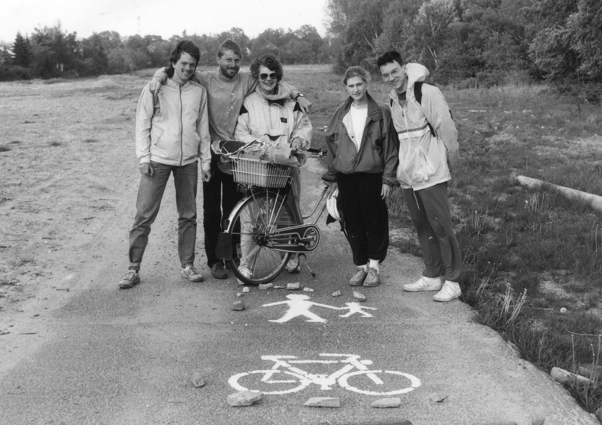
The wall trail cobblestone line is a double row of stones set into the ground along the path of the inner Wall across Mitte and Kreuzberg. It is not a raised wall. It is a flush pavement marker. It appears and disappears without warning. Between Bernauer Strasse and Mauerpark the stone line is well maintained. South of Mauerpark it becomes intermittent. By the time you reach the East Side Gallery, the line has ended and you are walking on the Spree bank. If the double row vanishes, look for the waymarked Mauerweg signs posted on lampposts and traffic sign poles. The signs carry the Mauerweg logo and a distance marker. The line is easy to miss. Use the official map as a backup.

Bernauer Strasse to Mauerpark Walk: What You See
The Bernauer Strasse to Mauerpark walk is the single best introduction to the Wall for anyone with a half day. Start at the Bernauer Strasse Wall Memorial. The outdoor exhibition is free. You see an intact death strip with the original patrol road, the watchtower, and a reconstructed border fence. Walk north. In 10 minutes you reach the Bösebrücke at Bornholmer Strasse, the first border crossing opened on 9 November 1989. Continue along the path through Mauerpark. The park was the death strip between Wedding and Prenzlauer Berg. On Sundays the Mauerpark flea market and karaoke bowl fill the space. Cash is mandatory at the food stalls. The nearest public toilet costs a euro. No free option within several hundred metres. Total walking time:1 hour if you do not stop. Budget 3 hours with the memorial and the park.
What the Three Sections Cost
SectionDistanceWalking TimeCycling TimeS-Bahn Return FareBernauer Strasse to East Side Gallery7 km2-3 hours45 minA single AB zone ticket, set by BVG, costs a few euros. Check the BVG app for the current fare.Treptow to Schönefeld15 km4 hours1.5 hoursA single AB zone ticket, set by BVG, costs a few euros. Check the BVG app for the current fare.Wannsee to Lichterfelde Süd20 km5 hours2 hoursA single AB zone ticket, set by BVG, costs a few euros. Check the BVG app for the current fare.
Stages That Run on Actual Patrol Road
Stage 14 includes a segment from Griebnitzsee to Lichterfelde Süd that follows the original Kolonnennweg patrol road. The surface is preserved asphalt with the characteristic narrow width. Stage 1 at Bernauer Strasse also runs on the original patrol road surface. Stage 2 from Nordbahnhof to Wollankstraße follows the inner-city path through Mauerpark but does not stay on the patrol road. Stage 13 from Wuhletal to Schöneweide runs nearby the patrol road but follows the river and industrial edge. If you want the authentic border patrol road experience, pick Stage 14 between Griebnitzsee and Lichterfelde Süd. The path is flat, straight, and uninterrupted.
What Goes Wrong on This Page
The most common mistake is trying to find a single continuous wall to walk along. The Mauerweg is a loop of fragments. The double stone line through the centre is the closest you get to a continuous marker, but it disappears at the Spree. Many well-known venues from the 1990s are now demolished or turned into luxury apartments. The Kunsthaus Tacheles ruin is now gutted flats. The original Tresor vault is closed and relocated. The WMF Club site is a hotel. You need imagination and the official map to connect the past to the present.
Practical Next Step
Download the official Mauerweg map from the Senatsverwaltung für Mobilität, Verkehr, Klimaschutz und Umwelt (Berlin) before you arrive. The 2006 revision is the one you need. Open the BVG app and buy a day ticket. The AB zone day pass price is set by BVG; check the app for the current figure. Do not attempt the 160 km loop. Pick the Bernauer Strasse to East Side Gallery section for a half day, the Treptow to Schönefeld section for a full day on foot, or the Wannsee to Lichterfelde Süd section for a full day by bike. The single thing that most often goes wrong is forgetting to stamp your ticket in the small red box on the platform before boarding. A €60 on-the-spot fine ends the day early.
Read next
-
 East Side Gallery
-
 Checkpoint Charlie
The guardhouse at Checkpoint Charlie is a replica from 2000. Here is what is original Cold War fabric, what is a set, and where the real booth ended up.
Checkpoint Charlie
The guardhouse at Checkpoint Charlie is a replica from 2000. Here is what is original Cold War fabric, what is a set, and where the real booth ended up.
-
 Charlottenburg
-
 Mitte
Mitte
-
 Prenzlauer Berg
-
 Friedrichshain
-
 Neukölln
-
 Kreuzberg
-
 Berlin 1990s Films Run Lola Run Sun Alley and Berlin Babylon What They Captured
Run Lola Run, Sun Alley, and Berlin Babylon each captured a different Berlin of the 1990s — the first a sprint through the post-Wall city, the last a techno-scored documentary of its construction.
Berlin 1990s Films Run Lola Run Sun Alley and Berlin Babylon What They Captured
Run Lola Run, Sun Alley, and Berlin Babylon each captured a different Berlin of the 1990s — the first a sprint through the post-Wall city, the last a techno-scored documentary of its construction.