Kreuzberg: The SO36 Dead End That Became Berlin's Middle
- Flag
-
- ISO code
- DE
- Currency
- EUR
- Timezone
- Europe/Berlin
Kreuzberg: the SO36 Dead End That Became Berlin’s Middle
Kottbusser Tor at 3am on a Friday is not beautiful. The U1 train clatters overhead on its elevated track. A Döner shop on the corner blasts fluorescent light through its own grease haze. A cluster of people argue in Turkish and German outside the Späti. This is the moment the dead end became the middle, the place that proved geography could rewrite history. For twenty-eight years, postal code 10961 was a West Berlin peninsula boxed on three sides by the Wall: north along the Spree, east along the Spree, south along the Landwehrkanal. It was the end of the line, a cheap immigrant and squatter enclave nobody in power cared about. Then the Wall fell. The dead end became the centre of a reunified city. The walk from Kottbusser Tor to Görlitzer Park still shows the 1990s scars. The late-night food strips still serve the 3am post-club crowd that has been coming here for thirty years.
Kreuzberg SO36 Punk History
The SO36 name came from the old postal delivery district Südost 36, and it was never a tourist destination. By 1981, around 160 buildings in the neighbourhood were squatted. Most were abandoned tenements landlords let rot because nobody wanted to live in a dead end surrounded by death strip. The punk scene that grew here was not performative. The club SO36 opened in 1978 at Oranienstraße 190, 10999 Berlin, and became the venue for a city that felt sealed off from the rest of the world. It still operates today. The crowd has changed.
The squats that survived the 1990s legalisation waves became the bones of the neighbourhood. Köpi at Köpenicker Straße 137, 10997 Berlin was legalised and remains occupied. The Regenbogenfabrik at Lausitzer Straße 22, 10999 Berlin was legalised in 1983 and runs as a cultural centre. Tommy-Weisbecker-Haus at Wilhelmstraße 9, 10963 Berlin took the same path. These are not museums. Walk past them at night and you hear music through the windows. The graffiti on the façade is not curated.
What the 1990s Left Standing
The wave of new squats after the Wall fell hit mainly in former East Berlin, not here. The Mainzer Straße occupation in Friedrichshain, directly across the Oberbaumbrücke from this district, was evicted on 14 November 1990 in a police action that defined the decade. Kreuzberg watched and learned. What remains is a neighbourhood that still operates partly on the honour system of the 1990s bar scene: cash only, no sign on the door. If you look confused, someone will tell you the price.

Görlitzer Park Berlin Wasteland
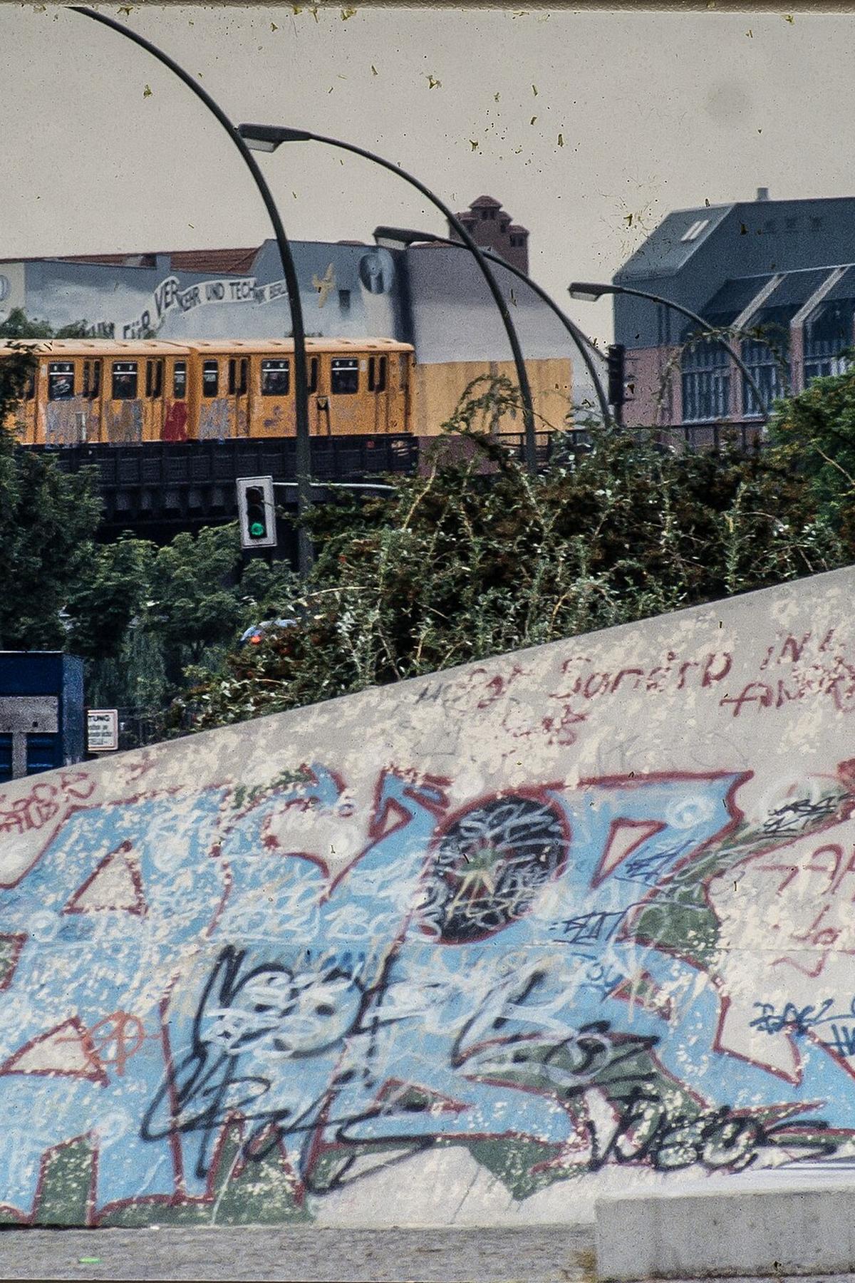
Görlitzer Park opened in 1994 on the site of the former Görlitzer Bahnhof, a railway station that had been a ruin since the war. For forty years the land sat as wasteland along the south edge of the district, a dead zone nobody could reach because the Wall ran along the Landwehrkanal. After 1989, the city turned it into a park without fully erasing what it had been. The train platform edges are still visible. The park never got the manicured treatment West Berlin parks received. It is raw, open, and used by everyone.
The wasteland park is also a site of street tension. Kreuzberg has not smoothed over its 1990s conflicts. The open drug trade in Görlitzer is not hidden. You see it during the day. You see it more at night. Berlin wears its 1990s scars visibly, and this park is one of the most visible. The trade is a direct line back to the post-reunification shock, when the neighbourhood went from a quiet dead end to a central transit corridor and nobody had money to police it properly. Bring kids to the playground near the Regenbogenfabrik end before dusk. Skip the central paths after dark.
May 1 Riots Berlin Kreuzberg
The May Day riots in Kreuzberg started in 1987, a year before the Loveparade began in Charlottenburg. The peak was 1990, the year after the Wall fell, when mass rioting in SO36 overwhelmed police. Oranienstraße was the key location then and remains the address to know. Every May 1 from 1991 through 1999, the annual violent clashes between autonomous groups and police centred on this street and Kottbusser Tor. The neighbourhood still marks the date. If you visit on May Day morning, you will see boarded windows. The police presence is heavy by noon. The riot legacy is not a tourist attraction. It is a lived memory that changes how the streets operate one day a year.
The street tension that fuels those dates is the same tension that made the area affordable in the 1990s and keeps it from becoming sanitised now. The neighbourhood is not dangerous on a regular night. But the friction between the Turkish community, the artists, the students, and the police is real. It is not resolved. You feel it most around Kottbusser Tor at U-Bahn closing time.
Berlin Turkish Döner Kebab Kreuzberg
The Döner kebab in this part of Berlin is the post-club food that rebuilt the neighbourhood. The Turkish community settled here as guest workers in the 1960s and 1970s, then got trapped in West Berlin when the Wall went up. They turned a cheap meat sandwich into the city's staple street food. Prices in 2026 run from a few euros at corner shops near the Tor up to higher figures at places calling themselves gourmet. The cheap shops are the real ones. Check the board outside before you order; every shop sets its own price and the official menus change.
The Turkish-origin population of the SO36 postcode in the 1990s was around 30 to 35 percent. That share shaped everything: the grocery stores that stay open late, the bakeries that sell Pfannkuchen at 4am, the lentil soup that appears on Volksküche menus at donation-based squat kitchens. The Döner is the most visible legacy. It is not the only one.

Oranienstrasse Late Night Food
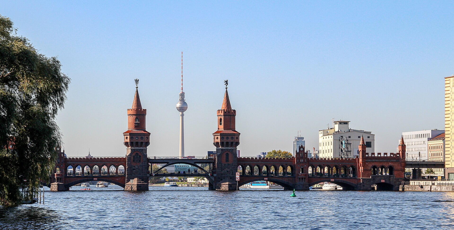
Oranienstrasse is the strip. The address range is Oranienstraße, 10999 Berlin, running from Kottbusser Tor east toward the Spree. By midnight, the street is a parade of people leaving clubs, bars, and squatted cultural centres. The late-night food options cluster between the U-Bahn exit at the Tor and the Oberbaumbrücke. You find Döner shops, a Currywurst kiosk, a 24-hour bakery selling Pfannkuchen, and at least one Imbiss that still serves the Boulette meatball, the working-class staple of the squatter days.
What to Eat and Where
Konnopke's Imbiss is the famous name, but it is not on Oranienstrasse. It sits under the U2 tracks at Schönhauser Allee 44b in Prenzlauer Berg, open since 1960, and it survived the 1990s unchanged. For Kreuzberg proper, the late-night soup at a former squat kitchen is the move. The Volksküche-style lentil soup or solyanka runs on donation at places that do not advertise. Find them by following the crowd. Oranienstrasse at 3am does not need a reservation. It needs cash. The bars and Imbisse that survive from the 1990s do not take cards. Budget for that.
Common Questions
What does SO36 mean in Kreuzberg?
SO36 is the former postal delivery district Südost 36, covering eastern Kreuzberg. The code was reused as the name of the SO36 club at Oranienstraße 190 and became shorthand for the punk and alternative scene of the 1980s and 1990s.
Where was the Berlin Wall in Kreuzberg?
The Wall ran along the north and east edges of SO36 at the Spree River, and along the south edge at the Landwehrkanal. The western edge near Checkpoint Charlie was the only side not enclosed by Wall. The Oberbaumbrücke was a closed border crossing from 1961 until 1994 for vehicles and 1995 for the U1 line.
Is Görlitzer Park safe at night?
The park is used by everyone but has an open drug trade, especially after dark. The central paths are not well lit. Stick to the edges near the Regenbogenfabrik or the Landwehrkanal side if you are passing through after sunset. The park was a wasteland before 1994 and still feels like one in places.
What happens in Kreuzberg on May 1?
May Day in Kreuzberg brings the annual riot legacy. Oranienstraße and Kottbusser Tor see heavy police presence, boarded windows, and clashes between autonomous groups and police. The tradition started in 1987 and peaked in 1990. It is not a festival. Avoid the area unless you are there specifically to observe the political demonstration.
How do I get from Kottbusser Tor to the East Side Gallery?
Walk north from Kottbusser Tor about 600 meters to the Oberbaumbrücke at 10997 Berlin. Cross the bridge to the Friedrichshain side. The East Side Gallery starts at the bridge and runs 1,316 meters north along Mühlenstraße. The bridge itself was a Wall crossing point and reopened to pedestrians and vehicles on 9 November 1994.