The Loveparade Route Through Berlin: What Is Standing There Now
The Berlin Loveparade route ran from Kurfürstendamm through Ernst-Reuter-Platz to the Tiergarten. Here is what occupies that exact parade path now at each stop.
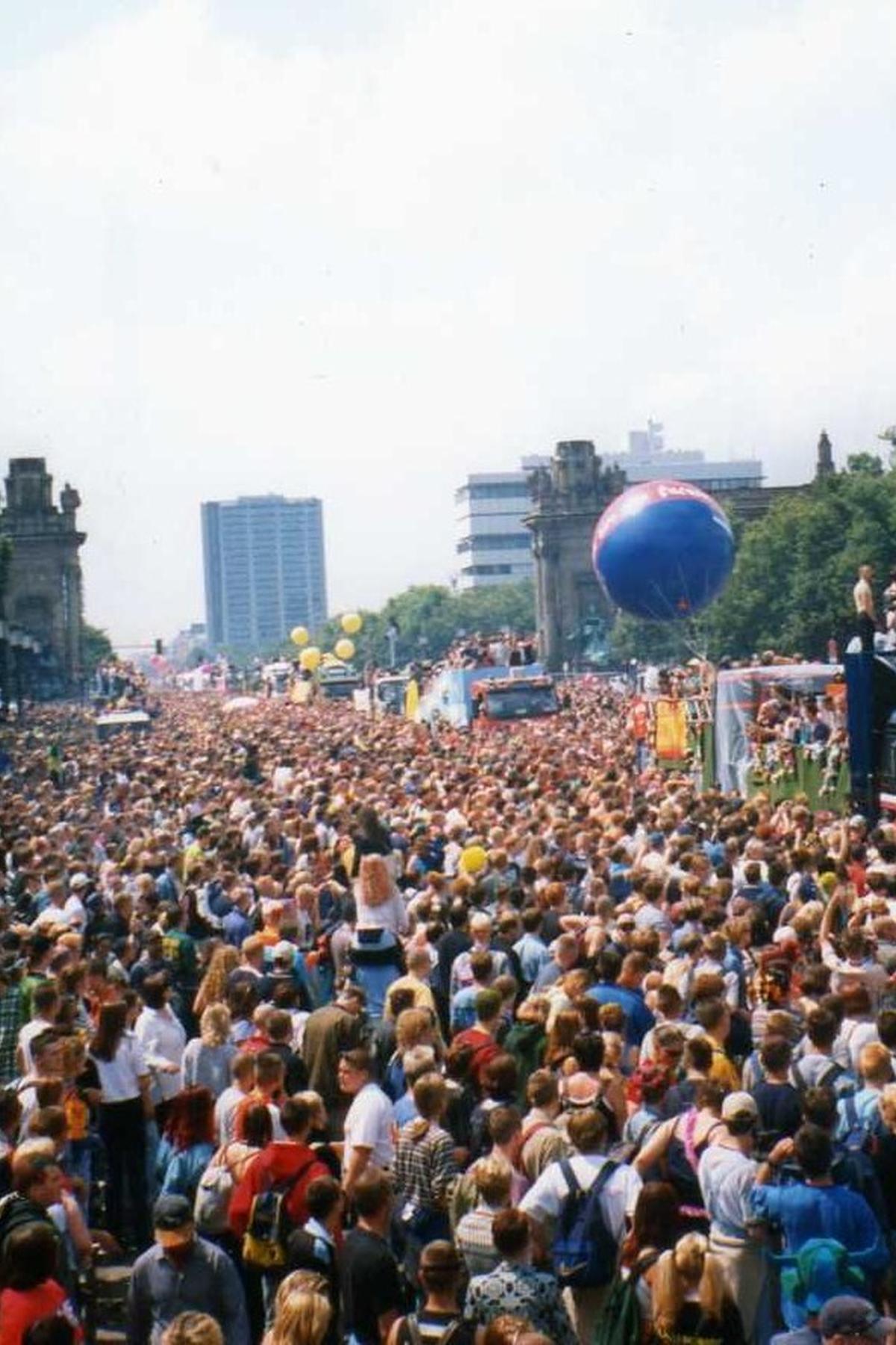
The Loveparade route starts in your own feet. Walk the same asphalt the sound trucks rolled across, from the Ku'damm to the Siegessaule, and what stands there now is ordinary city street with one buried exception. The parade never left a plaque, a line of cobblestones, or a memorial. It left the Tiergarten, the Straße des 17. Juni, and a decade of eviction notices that ended when Berlin said it would not pay the rubbish bill. Tracing the route means crossing a vanished geography you can still cover in under an hour, encountering nothing that announces the crowd who stood there in July 1999.
The Loveparade Berlin Route Then and Now: the 1989 Start on the Ku’damm
The first Loveparade, on 1 July 1989, registered as a political demonstration. Dr. Motte (Matthias Roeingh) and about 150 people walked the Ku'damm carrying a boom box and the slogan Friede, Freude, Eierkuchen (Peace, Joy, Pancakes). The music was early techno and acid house. The route was a single straight line on the main shopping boulevard of Charlottenburg, West Berlin. It was not a parade yet. It was a party dressed as a protest so the police would not shut it down.
What is on the Ku'damm now? Retail, cafes, the same 19th-century apartment blocks, and the ruin of the Kaiser Wilhelm Memorial Church. The street is a normal commercial artery. No marker identifies the start point. The only remnant of the 1989 moment is the street itself: wide, unbroken, and still the address of the demonstration that grew into something the city could not contain.
Ku'damm Loveparade Path: What Changed and What Did Not
The path from 1989 to 1995 was the entire route. The parade grew from 150 people to hundreds of thousands over six years, all funneled into the same boulevard. By 1995, the city could not manage the crowd. The route shifted in 1996 to the Straße des 17. Juni through the Tiergarten, a road wide enough to absorb the numbers. The Ku'damm itself changed in the 1990s too: the rough edges of post-Wall Berlin softened as international chains moved in. Today it is the city's second shopping strip, not a place where 150 ravers would start a revolution on foot.
Tiergarten Loveparade July: the 1996 Route Shift and the 1999 Finale
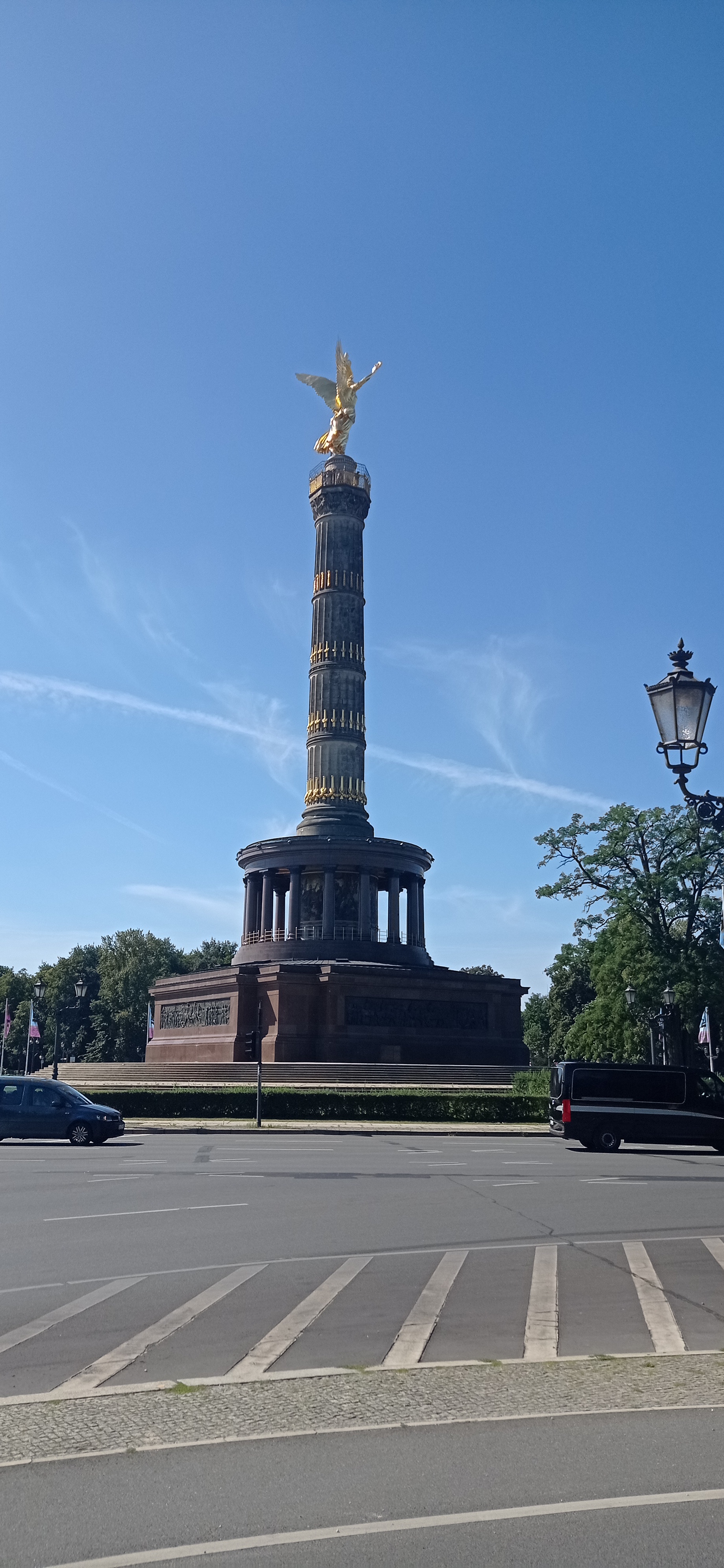
The Tiergarten route, used from 1996 to 2003, began at the Großer Stern (the roundabout around the Siegessaule, the Victory Column) and ran 2.0 km east along the Straße des 17. Juni to the Brandenburg Gate area. The parade crossed 210 hectares of parkland on one side and the Soviet War Memorial on the other, about 300 m north of the Großer Stern. The road surface is asphalt. The sidewalks and cycle lanes are public every day. You walk it alone.
The peak year was 1999, with approximately 1.5 million participants. That was the last year the Loveparade felt like Berlin's own. In 2001, the Berlin Senate revoked the parade's demonstration status. The Federal Administrative Court ruled the event had become commercial, forcing a change in the route's legal basis. A new rule required one support vehicle per 50 participants. The parade never recovered the numbers. Berlin held the last Loveparade in 2003. The city claimed DM 400,000 in rubbish-removal costs in 2001 and demanded the organizers pay. In 2004, a funding dispute over those costs plus the rubbish-removal fees stopped the event outright.
Berlin Loveparade Final Route: The Exact Line You Walk Today
The final route, the one from the Großer Stern to the Brandenburg Gate, is still the most walkable segment of the whole history. Start at the Siegessaule (open to visitors; check the entry fee with the Berlin tourism office before you go). Walk east on the Straße des 17. Juni. Pass the Soviet War Memorial on your left after 300 m. Continue straight for 2.0 km. End at the Brandenburg Gate, specifically the Platz des 18. März. The road is open to traffic. You share it with cars and bicycles. The only sound is regular street noise. No sound system marks the route. No commemorative plaque was ever installed.
Loveparade History Berlin: Why the Route Stopped and What the City Did with the Space
The Loveparade history Berlin tells is one of legal reclassification. From 1989 to 1995, the parade registered as a political demonstration. From 1996 to 2001, it operated under the same legal framework on the Straße des 17. Juni. In 2001, the Federal Administrative Court ruled the event commercial. The Berlin Senate revoked the demonstration status. The city demanded cleanup costs. The organizers could not pay. The 2003 parade went ahead but the route was abandoned in 2004 when the funding dispute and rubbish-removal cost claim from the city could not be resolved.
The Duisburg endpoint in 2010 is the reason it stopped permanently. A crowd disaster at the Loveparade in Duisburg killed 21 people and injured hundreds. The event never returned to Berlin. The route in Berlin remains unchanged physically, but the city did not mark the loss. The Straße des 17. Juni is still a ceremonial axis: the annual Berlin Marathon crosses it, the New Year's Eve run uses it, and every so often a demonstration fills it again. The difference is the absence of sound trucks and the crowd who once stood on the grass.
What Physically Occupies Each Section of the Route Now
From the Ku'damm to the Siegessaule, the route has three distinct segments, each with a different present-day character.
Ku'damm (1989 Start)
Retail and restaurants. The sidewalk is wide and crowded on weekends. The 1990s squats on side streets are gone or converted. The street is a normal urban boulevard. The only Cold War era holdout is the Ku'damm Eck shopping center, built in 1974 and still standing. No Loveparade marker exists.
Straße des 17. Juni (1996-2003 Route)
Asphalt road with sidewalks and cycle lanes. The Tiergarten park on both sides is maintained as a public park. The Soviet War Memorial is a granite-and-marble monument from 1945, maintained by the German government. The Siegessaule is a tourist attraction with a viewing platform (entry fee set by the Berlin tourism office). The road itself carries car traffic at 50 km/h. On summer weekends, it fills with cyclists and joggers. No Loveparade marker exists.
Brandenburg Gate / Platz des 18. März (1999 Finale End Point)
The Brandenburg Gate is a pedestrianized monument. The Platz des 18. März is the square in front of it. This is the busiest tourist intersection in Berlin. The gate was closed to traffic after the Wall fell and remains closed. The square hosts political rallies, New Year's Eve celebrations, and the finish line of the Berlin Marathon. No Loveparade marker exists.


Who This Subject Suits and Who Should Skip it
The Loveparade route suits Cold War history completists who want to trace a vanished 1990s event across a city that has rebuilt over its own recent past. It suits techno and club-culture pilgrims who know the music started in Berlin's squatted basements and want to see the empty corridor where it went public. It suits second-time Berlin visitors digging past the greatest hits, and photographers chasing post-industrial decay in a city that curated its grit instead of covering it up.
Skip it if you are a first-time Germany visitor who wants a fairy-tale old town. Berlin's 1990s layer is deliberately broken, sprawling, and emotionally heavy. The route is a 2.0 km walk on a busy road with no signage and no preserved artifact. If you need a walkable, pretty historic core, walk the Unter den Linden instead.
The single thing that most often goes wrong: visitors assume the Loveparade left a physical trace. It did not. You will stand on the Straße des 17. Juni, look at the asphalt and the park grass, and find nothing that tells you a crowd of 1.5 million was there. The route is a story you have to bring with you, not one the city will show you.
Read next
-
 East Side Gallery
-
 Checkpoint Charlie
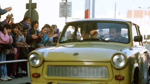
The guardhouse at Checkpoint Charlie is a replica from 2000. Here is what is original Cold War fabric, what is a set, and where the real booth ended up.
Checkpoint Charlie
The guardhouse at Checkpoint Charlie is a replica from 2000. Here is what is original Cold War fabric, what is a set, and where the real booth ended up.
-
 Charlottenburg
-
 Mitte
Mitte
-
 Prenzlauer Berg
-
 Friedrichshain
-
 Neukölln
-
 Kreuzberg
-
 Berlin 1990s Films Run Lola Run Sun Alley and Berlin Babylon What They Captured
Run Lola Run, Sun Alley, and Berlin Babylon each captured a different Berlin of the 1990s — the first a sprint through the post-Wall city, the last a techno-scored documentary of its construction.
Berlin 1990s Films Run Lola Run Sun Alley and Berlin Babylon What They Captured
Run Lola Run, Sun Alley, and Berlin Babylon each captured a different Berlin of the 1990s — the first a sprint through the post-Wall city, the last a techno-scored documentary of its construction.